

Origin Story: OHK and Egypt's New Administrative Capital
From Inspiration to Implementation: The OHK Study Tour that Shaped the Beginnings of Egypt's New Administrative Capital
Origin Story is a new series from OHK, created to shine a light on landmark projects we helped launch—projects whose earliest chapters and OHK’s catalytic role often remain untold. Through these posts, we peel back the curtain on how ideas took shape, decisions were made, and strategies were forged, from first epiphanies to concrete policy blueprints.
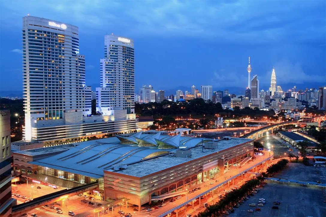
This is Part 1 of Origin Story: OHK and Egypt's New Administrative Capital titled “From Putrajaya to the Desert: The 2002 Study Tour that Ignited Egypt’s New Capital Vision.” The conception of Egypt’s New Administrative Capital (NAC) is a story of visionary planning inspired by global best practices. This journey began with a pivotal study tour in 2002, organized by a team from OHK. The tour aimed to expose Egyptian officials to Malaysia’s Putrajaya, a modern administrative capital that combines urban functionality with sustainability. This experience laid the groundwork for what would become one of the most ambitious urban development projects in Egyptian history. The conception of Egypt’s NAC did not emerge overnight; it germinated in the fertile soil of curiosity, comparison, and big‑picture thinking. In early 2002, the Government of Egypt was wrestling with mounting congestion in Cairo, chronic infrastructural overstretch, and the political symbolism of an over‑crowded historic capital. Against that backdrop, a small interdisciplinary delegation—hand‑picked by OHK—embarked on a ten‑day study tour to Southeast Asia.
A Journey, Not a Junket—Looking back from 2025, the study tour stands out not as a box‑ticking junket but as a catalytic learning expedition. It blended site visits, behind‑the‑scenes technical briefings, and real‑time strategy workshops—all choreographed by OHK with an eye toward fast translation into policy. The plane tickets, bus rides, and hotel nights—funded by USAID—cost a fraction of one interchange flyover on Cairo’s Ring Road, yet the intellectual returns have multiplied across two decades of planning, legislation, and construction. That is why, when historians narrate Egypt’s twenty‑first‑century urban pivot, the February 2002 Putrajaya study tour often appears as Chapter One. This is Part 1 of OHK’s post; it is the origin‑story chapter of the narrative. It recounts the February 2002 study tour that OHK organized for senior Egyptian officials to Malaysia’s purpose‑built capital, Putrajaya. In short, Part 1 tells the story of the study tour itself. Part 2 will pick up from where the study tour left off—tracing how those early principles introduced by OHK have been translated into, or diverged from, the on-the-ground realities of Egypt’s New Administrative Capital as of 2025.
Reading Time: 20 min.
The New Administrative Capital of Egypt, a massive undertaking aimed at decongesting Cairo and fostering a new era of governance and urban living, can trace its conceptual roots back to an influential study tour—this tour was not just a visit; it was the beginning of a visionary transformation.

In 2002, Ahmed al-Okelly and Hoda Hamdy of OHK facilitated a two-week study tour to Malaysia's administrative capital, Putrajaya, for leading and young representatives from the Egyptian government. The selection of participants was strategic, aiming to include those who could integrate new ideas into their work—urban and tourism planners and officials from critical organizations like the Tourism Development Authority and the New Urban Communities Authority. The objective of the tour was to expose the delegation to Putrajaya’s innovative planning and governance models. Through intensive workshops and interactions with various Malaysian departments, the group explored advanced spatial planning and the creation of federal administrative capitals. This experience was crucial, as Egypt’s previous satellite cities had suffered from inadequate planning, and tourist towns had expanded rapidly with little foresight.
Cairo's urban landscape is characterized by staggering statistics and latent infrastructure challenges. With a population exceeding 20 million, the city stands as one of the world's most densely populated urban centers. Cairo's population density is exceptionally high, with a density of around 32,000 people per square kilometer. This places Cairo among the most densely populated cities globally, surpassing other megacities like Tokyo and Mumbai.
Cairo’s density is palpable in the tightly packed residential neighborhoods and mid-rise buildings that dominate Cairo's skyline. The relentless influx of rural migrants adds further strain, with an estimated half a million people moving to Cairo annually in search of economic opportunities. This migration fuels demand for housing and exacerbates building density, as informal settlements proliferate on the city's periphery. The proliferation of vehicles on Cairo's streets tells a similar story. With over 4 million cars registered in the city, traffic congestion has become a daily ordeal for residents, costing the economy billions of dollars annually in lost productivity and wasted fuel. Contrasting with cities like Paris, where OHK is also based, and where efficient public transportation systems have been in place for decades, Cairo's urban challenges appear more pronounced. Paris, with a population of around 2.2 million in the city proper and extensive metro and bus networks, boasts a significantly lower population density of approximately 21,000 people per square kilometer and less reliance on private vehicles for daily commuting.

Cairo's infrastructure faces multiple challenges, including the delayed implementation of mass transit systems such as subways and inadequate bus services. These shortcomings exacerbate the city's traffic congestion and limit mobility options for its residents. With its dense population, Cairo also struggles with severe pollution levels, particularly air pollution, which consistently surpasses the safe limits set by the World Health Organization. The city's heavy reliance on automobiles is evidenced in a ratio of roughly one car for every five residents. In contrast, Paris, which has significantly lower car ownership rates of about one car for every three residents, has better air quality. This is largely due to its comprehensive public transportation networks and environmental policies that promote sustainable mobility. Interestingly, both cities share historical connections to transformative urban planning during the late 19th century. The above photo illustrates the current contrast, depicting a common occurrence of dense urban environment and traffic congestion in Cairo at locations such as the October Bridge and Ramses Square, marked by extensive vehicle use and limited space.

Similarly, cities such as Tokyo and New York City, despite their high population densities, have lower car ownership and pollution levels, thanks to efficient public transit systems and a culture that encourages walking and cycling. Tokyo, with a population of over 37 million in its metropolitan area, spans approximately 2,194 square kilometers, resulting in a population density of around 17,000 people per square kilometer. Despite its large population, Tokyo maintains relatively low pollution levels compared to Cairo, with air quality typically meeting international standards due to robust environmental regulations and extensive public transportation infrastructure. Car ownership in Tokyo is notably lower than in Cairo, with approximately one car for every seven residents. New York City, with a population of around 8.4 million in its five boroughs, occupies an area of approximately 783 square kilometers, resulting in a population density of roughly 10,800 people per square kilometer. While New York City's population density is lower than Cairo's, it is still considered high by global standards. However, pollution levels in New York City are significantly lower compared to Cairo, with the city implementing strict emissions standards and promoting public transit use. Car ownership in New York City is also lower than in Cairo, with approximately one car for every three residents, reflecting the city's emphasis on alternative modes of transportation and compact urban design.
In light of pressing urban challenges and infrastructure deficits, the rationale for establishing satellite cities and decentralizing services has become compelling. Several satellite cities were built around major urban centers like Cairo and Alexandria, including the 6th of October City, New Cairo, Sheikh Zayed City, Al Rehab City near Cairo, and Borg El Arab near Alexandria. These cities were initially intended to ease population pressure and promote sustainable urban development. However, they face challenges such as infrastructure limitations, inadequate transportation systems, increased urban sprawl, the difficulty of integrating these new cities efficiently with main urban centers, and socioeconomic disparities.
While contributing to decentralization efforts, these cities have introduced many privately-led gated estates and real estate developments that predominantly benefit higher-income groups, potentially leading to greater economic stratification. In addition, in Egypt, more than any other African country, there has been a significant move towards delegating large-scale residential development to private entities. The private master developer’s involvement is seen as a way to bring in investment, expedite development, and implement modern urban planning principles that might be more challenging for the public sector to execute due to budgetary or bureaucratic constraints. This has presented several significant challenges. (1) The infrastructure intended to connect these new developments to existing urban areas often falls behind or is incomplete, resulting from the ad-hoc, "as-you-go" nature of these projects, where comprehensive planning does not guide rapid construction and infrastructure does not precede densification. (2) The design of these cities stayed heavily car-centric, lacking robust public transit systems, which exacerbates Egypt's major urban issue—the over-reliance on automobiles. This approach leads to increased congestion and pollution and neglects those without access to private vehicles. (3) Additionally, there is a noticeable lack of public spaces, affordable housing options for lower-income individuals, and cohesive infrastructure, such as sufficient civic services, parking, and amenities. This lack of inclusive planning contributes to social segregation and diminishes the overall quality of life, limiting benefits to a wealthier demographic while excluding broader community benefits.

The photo above shows the road leading to and within the 6th of October City in Egypt, illustrating significant urban planning challenges. Dominated by cars, the image captures a heavy reliance on personal vehicles due to a lack of public transportation options, underscoring the area’s car-centric infrastructure. Additionally, the roads are often in varying stages of completion, indicating an "as-you-go" approach to infrastructure development that fails to precede or keep pace with growth. The absence of pedestrian paths, green spaces, or other public amenities is noticeable, highlighting a lack of inclusive urban planning focused on community interaction and accessibility.
In 2001, our team saw an opportunity to rethink Egypt's satellite city paradigm and conducted a workshop that mapped critical issues from the lack of integrated public transportation, inadequate infrastructure, economic segregation, social disconnection, environmental degradation, a cultural disconnect from the greater Cairo metropolitan area, and the need to alleviate the burden of densely centralized government functions, a legacy of autocratic governance, which has contributed heavily to urban congestion.
We concluded that relocating government offices and public services to a new city directly addresses Cairo's congestion and infrastructure strain by decentralizing key functions that traditionally attract large daily populations to the city center. This strategic shift can reduce Cairo's urban load, helping to alleviate traffic congestion and decrease the demand for transportation services. Historically, Egypt has had a high number of public servants and a substantial bureaucracy, with the distribution of this workforce primarily working in Cairo’s urban centers and commuting from less centralized or peripheral areas due to their lower-income status. For example, Mogamma al-Tahrir, a single building located in one of Cairo's most congested squares, once hosted up to 30,000 public servants, showcasing how bureaucracy can overwhelm urban conditions. In 2020, twenty years after our workshop, Egypt’s Central Agency for Public Mobilization and Statistics (CAPMAS) estimated nearly 800,000 employees in the public and public business sectors, with approximately 40% located in Cairo. Contrasting this with Egypt's 2020 population, which was approximately 100.6 million, and Cairo's population, which was about 9.95 million, they constituted nearly 3.2% of Cairo's population—the figure of 9.95 million refers specifically to the population of Cairo Governorate, which is a more confined area, while the 20 million refers to the entire Greater Cairo metropolitan area, which includes additional surrounding areas like Giza and parts of the Qalyubia Governorate.
The study tour to Putrajaya was designed to introduce the concept of constructing a government hub city from the ground up, thereby inspiring the genesis of the idea for Egypt's New Administrative Capital. Putrajaya represented a modern planned city, which Egypt could use as a model to understand the complexities and challenges of developing a large-scale urban project from scratch. This includes learning about efficient land use and integrating modern infrastructure and a public transit system. Additionally, how Putrajaya managed government functions within the city offers insights into effective governmental relocation and the distribution of services.

The development of Putrajaya itself represents one of the earliest and most significant steps in the Malaysian government's initiative to move administrative functions out of Kuala Lumpur to alleviate urban congestion. This planned city, inaugurated in the late 1990s, was designed to serve as the new administrative center of the country, hosting key government ministries and agencies. The relocation was part of a broader strategy to promote administrative efficiency and develop other regions of Malaysia by distributing the functions of government more evenly across the country. The Palace of Justice is a key landmark in this vision, as shown in the photo above. This grand structure now serves as the home for the Malaysian Federal Court and the Court of Appeals, and is a prime example of the unique architectural blend of modern and traditional elements that characterizes Putrajaya.
From Cairo’s jam‑packed streets to Malaysia’s lakeside Putrajaya, the idea of building Egypt’s NAC has always been a story of contrasts—between overcrowded megacity and purpose‑built garden city, between inherited congestion and designed efficiency. What began as a two‑week study tour in 2002 quickly snowballed into one of the largest green‑field government relocation project in the Middle East. The sections that follow trace that journey in seven tightly focused themes. First comes the moment the idea clicked for OHK’s planners; next, the translation of inspiration into concrete blueprints; then the political and financial hustle that turned sketches into budget lines. We move on to the capital’s forward‑looking design DNA, celebrate early victories while owning up to stubborn pains, and finally distill exportable lessons for other nations imagining new seats of power—before casting an eye toward NAC’s milestones and OHK’s legacy role.
From In‑Flight Epiphany to Policy Blueprint: How a Dog‑Eared Notebook Turned Putrajaya’s Spark into Egypt’s New‑Capital Strategy
Ahmed Al‑Okelly—OHK’s lead strategist— still keeps the dog‑eared notebook he filled on the overnight flight back from Kuala Lumpur in July 2002. “It hit me that we’d just seen a capital designed after the motorway era, not before it,” he recalls. In the margin he jotted, “Cairo needs a purpose‑built core, not another dormitory town.” Within a week the OHK team issued a four‑page internal memo titled “Toward an Egyptian Administrative Hub,” distilling the Putrajaya lessons into six action points—chief among them: move ministries first, houses second; fund infrastructure up‑front; keep the civic heart walkable. That memo became the agenda for a closed‑door workshop held that October with three ministers in Egypt’s administration at the time.
Charting Insight, Infrastructure, and Inspiration: A Day‑by‑Day Narrative of the Two‑Week Malaysian Study Tour That Transformed Putrajaya’s Lessons into Egypt’s New‑Administrative‑Capital Blueprint

Day 0 – Cairo Launch Pad: Mapping Greater Kuala Lumpur and Arming Delegates with Data‑Hunting Workbooks
The delegation’s journey stretched over fourteen densely packed days that blended field observation, high‑level briefings, and nightly debriefs orchestrated by OHK’s facilitators. Day 0 began in Cairo with a closed‑door orientation in OHK’s Nile Tower office, where the OHK team unrolled satellite maps of Greater Kuala Lumpur and issued each participant a slim “comparative metrics” workbook to be completed en route. The “comparative metrics” workbook itself was deceptively modest—forty A5 pages bound in kraft‑paper covers that fit easily into a jacket pocket—but inside it was a strategic lens through which every site visit would be refracted. The opening spread laid out a one‑page cheat sheet titled “Why Measure?”, reminding delegates that impressions fade but numbers travel. From there, each double‑page followed the same disciplined template: the left page offered a concise primer on a single dimension of capital‑city building—land‑use mix, blue‑green infrastructure ratio, transit modal split, recurring‑revenue share, governance turn‑around time, and so on—while the right page was a gridded worksheet for field notes and raw figures.
A grey sidebar on every worksheet posed a single “translation question”: How would this metric map onto Greater Cairo?—forcing immediate contextualization rather than post‑trip hindsight. To keep entries honest, OHK inserted QR codes linking to live data dashboards; if a participant missed a bus‑frequency figure, they could scan and fetch the real‑time schedule. The final pages contained a “Synthesis Matrix”, a giant fold‑out where delegates would, on the return flight, transpose their most telling numbers into side‑by‑side columns—Putrajaya vs. Kuala Lumpur vs. (future) Cairo East—and circle the deltas that mattered. By the time wheels touched down at Cairo International, every notebook was heavy with ink, coffee stains, and the kind of quantified insight that could power a Cabinet presentation. It was, in effect, a portable think‑tank—one that ensured the tour’s revelations would be captured not just as memories but as actionable metrics ready to underpin Egypt’s new‑capital strategy.

The aerial image captures Brasília’s iconic “Plano Piloto.” The straight Monumental Axis slices north‑south, flanked by gleaming government blocks and the circular Estádio Nacional near the bottom. Residential super‑quadras form orderly white grids on either side, while Paranoá Lake’s blue arms embrace the peninsula, accentuating the city’s airplane‑like layout conceived by Lúcio Costa and Oscar Niemeyer. This view embodies modernist ambition—building an entirely new capital to relieve an overloaded coast and project national identity inland. Brasília’s triumphs and pitfalls were core to the delegation’s 2002 study‑tour homework, offering Egypt cautionary lessons on scale, car dependence, and the power of symbolic urban form.
Day 1 – From Gate Briefing to Homework Flight: Brasília‑Canberra‑Abuja Case‑Studies, Seat‑Pod Metrics Worksheets, and an Overnight Seminar aboard MH‑155 to Kuala Lumpur
On Day 1, the next evening the team boarded Malaysia Airlines Flight MH‑155, a nonstop to Kuala Lumpur; the air‑hours doubled as an airborne seminar on metropolitan relocation case‑studies. Once the delegation cleared immigration and gathered by the gate, OHK’s coordinators distributed slim kraft‑covered workbooks stamped “Flight Assignment.” Inside each were two parts: a short reading packet (three case‑study capsules on Brasília, Canberra, Abuja) and a three‑page worksheet entitled “Metrics to Hunt Down in Malaysia.” To make the quiet flight time count without disturbing fellow travelers, the coordinators had also arranged the seating so the delegates occupied a neat run of five triple‑seat blocks—Rows 24 A‑C through 28 A‑C—on the left side of the plane. Each group of three formed a working pod: Seat A (Window) – tasked with scanning the reading packet and underlining any land‑use ratios, density figures, or block‑size data worth benchmarking. Seat B (Middle) – responsible for extracting governance and funding details—development‑authority powers, PPP models, land‑value‑capture percentages—and scribbling them into the worksheet columns. Seat C (Aisle) – focused on mobility and public‑realm metrics, noting transit modal splits, average walk distances, and green‑space percentages.
The three capitals were hand‑picked because, taken together, they give the delegation a compact “world tour” of the most instructive precedents for building a brand‑new seat of government from scratch. Each one brings a distinct lesson Egypt’s planners need to weigh before they pour the first slab east of Cairo. Brasília (1960) shows what happens when a nation tries to leap‑frog an overcrowded coast by planting a monumental capital deep inland. Its superblocks and broad axes are a warning about over‑reliance on cars and the social cost of vast residential “wings” far from jobs. Canberra (1913) won a design competition to resolve Sydney–Melbourne rivalry. Its concentric parklands and lake system illustrate how topography‑driven planning and legally protected green belts can shape a capital’s identity for a century. Abuja (1991) replaced Lagos to provide a ethnically neutral, centrally located seat of power. Its incremental zones, reliance on expatriate consultants, and funding roller‑coaster mirror challenges Egypt faces in maintaining momentum through fiscal swings. In short, Brasília, Canberra, and Abuja supply the most focused mix of scale, climate, governance structure, financing method, and success‑vs‑shortfall data that Egypt’s planners can mine for metrics—exactly the homework the delegation needs during that quiet overnight flight. The worksheet’s final page posed a single shared challenge: “Circle two numbers that most surprised you; jot one sentence on how Egypt might match or beat them.” By the time the captain announced descent, every trio had a tidy bundle of figures—and, more importantly, a compact set of hypotheses—to test against reality once their feet hit Malaysian soil.

The photo shows Putrajaya’s Monumental Boulevard flanked by a ministry block whose façades and columns wear an intricate Islamic lattice. A 40‑metre‑wide shaded promenade—one lane of an overall 100‑metre‑wide, 3.2‑kilometre ceremonial axis—runs beside a double row of trees, granite pavers, way‑finding totems, and district‑cooling grilles inset at grade. During Day 2 the Egyptian delegation walked this exact stretch to test comfort and scale. They measured pavement width, canopy temperature (≈ 31 °C versus 34 °C in sun), and bollard spacing designed for rapid conversion to a pedestrian mall. Those metrics would inform the delegates own NAC’s target: a 90‑metre spine with 35 percent shaded public realm. That 90‑metre / 35 percent figure isn’t drawn from a publicly adopted NAC directive in Egypt.; it comes from the delegation’s own working paper “Toward an Egyptian Administrative Hub”—circulated internally by OHK on 26 January 2002 after the Putrajaya meetings. In that memo the we transcribed field measurements taken along Putrajaya’s 100‑metre boulevard, then proposed slightly tighter dimensions (90 m overall, minimum 35 % shaded public realm) as a starting benchmark for Egypt’s New Administrative Capital. Because the memo was an internal planning note rather than a released government report, it does not appear in external sources or archives.
Day 2 – Hilltop Morning Briefing, Boulevard Precinct Walkthrough, Lake‑Cooling Validation, and Sunset Debrief in a Still‑Emerging Putrajaya
Morning found the delegation gathered in the lobby of Putrajaya’s sole operating hotel—the 118‑room Putrajaya Shangri‑La, then a lone outpost amid construction cranes and graded red earth. From the breakfast terrace they watched sodium work‑lights flick off one by one as the sun backlit the unfinished domes of Perdana Putra and the skeletal arches of Seri Wawasan Bridge. At 8:30 a.m. the Chief Planner of Putrajaya Corporation unfurled a foam‑core timeline and traced the city’s rapid gestation: federal decree in 1993, ground‑break in 1995, lake impoundment in 1998, first ministry fit‑out earlier that very spring. Fortified by kopi tarik and roti canai, the group boarded a pair of coaster buses for an on‑the‑ground sweep of the nascent Boulevard Precinct. Hard‑hatted site managers guided them along freshly poured granite pavers, explaining how the four‑lane ceremonial spine was engineered with removable bollards and concealed ducting so traffic could be barred and the entire axis transformed into an uninterrupted pedestrian mall for Merdeka parades. Delegates paused at pre‑installed bronze survey markers—future flag‑pole locations—while bulldozers rumbled in the background grading parcels for yet‑unbuilt ministries.
After a quick lunch served from a mobile canteen (no other restaurants existed nearby), the convoy detoured to the silty banks of the still‑filling Putrajaya Lake. There they boarded a modest inspection barge normally used by project engineers. As the craft idled past re‑planted mangrove seedlings, an environmental officer demonstrated how afternoon lake breezes slipped between terraced office blocks, dropping ambient temperatures by nearly 3 °C on test days—an early validation of the master plan’s blue‑green cooling strategy. When they disembarked at a temporary jetty, sunset was already burnishing the half‑clad façades in copper light. The delegation jotted notes on wind direction and facade shading, then returned to the hotel—the only lit structure for kilometers—to debrief over curry puffs and flip‑chart sketches. In a city still more blueprint than built form, Day 2 delivered a tangible sense of momentum: ministries rising, streets already hosting test parades, and a man‑made lake breathing life into what had been, only a decade earlier, raw plantation land.

The photograph captures Putrajaya Lake at sunset, its still 6.5‑square‑kilometre surface mirroring pastel clouds and the pink‑granite Putra Mosque, whose 116‑metre minaret and 45‑metre‑wide dome dominate the horizon. Low early‑evening sunlight flares through the colonnades, casting a gold trail across water engineered to an average depth of 4 metres. On the left, treed embankments hide the Prime Minister’s Office, while the lake’s 38‑kilometre shoreline arcs gently out of frame. Designed in 1997–98 as Malaysia’s first large‑scale urban “water park,” the reservoir gathers storm‑runoff from 62 square kilometres of catchment and supplies district‑cooling make‑up water for the surrounding precincts. During Day 2 the Egyptian delegates cruised this lake with Putrajaya Corporation engineers, logging sensor readings that showed afternoon air temperatures over water averaging ≈ 3 °C cooler than adjacent streets. They learned how the lake’s wetlands strip 90 % of suspended solids before discharge and how controlled draw‑down prevents 100‑year flood levels downstream. These performance metrics bolstered OHK’s argument for a “Green River” spine in Egypt’s New Administrative Capital, treating blue‑green infrastructure as both climate moderator and public‑realm centrepiece.
Day 3 – Inside the Cooling Concessions: Plant Walkthrough, Funding Deep‑Dive, and Night‑Time Illumination Lessons at Putra Mosque
The third morning by 9 a.m. the delegation was donning hardhats and reflective vests at District‑Cooling Plant No. 2, a cavernous concrete vault sunk two storeys beneath what would later become the Commercial Precinct. A senior engineer from Putrajaya Holdings flipped open an A0 schematic pinned to a plywood wall and traced the closed‑loop chilled‑water network feeding half a dozen ministry blocks. He spoke not of pipes first but of tariffs: a 25‑year concession that guaranteed investors a baseline return if the load factor held above 70 percent. The message landed—utility finance could be as architectural as any skyline. Inside the turbine‑whine air, gauges read 4 °C supply, 14 °C return; thermometers dangled like limp pocket‑watches in the condensation mist. Delegates recorded coefficient‑of‑performance figures and paused for a moment when the engineer noted energy savings of up to 35 percent compared with standalone chillers—data later underlined in every workbook.
Late morning saw the group climb into safety lifts to a dusty mezzanine overlooking the future Alamanda retail site, still a grid of columns and scaffolds. Putrajaya Holdings’ finance director unpacked the math behind the forthcoming sukuk bond issue: land‑lease proceeds and anchor‑tenant advances would service coupon payments while retail sales taxes back‑stopped maintenance of public space. The OHK Team and Egypt’s officials traded notes, pencilling “land‑value capture?” in the margins. The afternoon shifted to the on‑site District Energy Control Centre, a windowed nerve‑cell where a wall of CRT monitors graphed real‑time demand curves. Operators demonstrated auto‑sequencing of chillers to shave peak loads. One screen flashed a future connection diagram—Phase 2 piping already planned but physical pipes delayed until occupancy crossed critical mass. The principle—build backbone early, expand taps later. As dusk drew in, the convoy rolled toward Putra Mosque on Core Island. Construction fences still hemmed the plaza, but exterior works were complete. Electricians ran final checks on façade luminaires timed to the evening call to prayer. At precisely 7:18 p.m., sodium uplights bathed the rose granite dome while low‑energy metal‑halide floodlights traced the minaret’s ribs—a choreographed glow that met religious function with energy‑budget discipline. By the time the coaster buses climbed back to the Shangri‑La’s hilltop driveway, the team had seen Putrajaya’s invisible infrastructure—pipes, bonds, and photons—working in concert. Day 3 cemented a crucial takeaway: Egypt’s new capital would succeed not on edifices alone, but on the engineered deals and utilities humming beneath its streets and lighting its symbols after dark.

This is District Cooling Plant 1 (DCP‑1) in Putrajaya, the first of the city’s centralized chilled‑water facilities. Located near Precinct 1, the plant supplies roughly 23,000 refrigeration tons (RT) of cooling, distributing 5 °C water through a 30‑kilometre closed‑loop network to federal ministries and nearby mixed‑use buildings. Its paired thermal‑energy‑storage tank—the cylindrical structure at left—lets operators shift much of the chiller load to off‑peak nighttime hours, cutting peak electricity demand by an estimated 18 %. The plant’s performance data and concession financing model were focal points of the delegation’s Day 3 technical walk‑through. Subsequent phases added two similar facilities in 2004 and in 2012—so by 2025 Putrajaya operates three district‑cooling plants supplying a combined capacity of roughly 70,000 refrigeration tons to federal offices, mixed‑use precincts, and lake‑front civic buildings. Putrajaya’s three‑plant, ~70 k RT system is mid‑sized by global standards—larger than many university or airport schemes but two‑thirds the capacity of Singapore’s Marina Bay and less than half of Downtown Dubai’s. Its phased rollout (1999‑2012) and use of thermal‑energy‑storage tanks offered the Egyptian study‑tour delegates a replicable template: start with a single 20‑25 k RT plant sized to early occupancy, design pipe corridors for future doubling, and finance expansions through concession extensions—an approach more realistic for a new capital than Dubai’s mega‑scale, single‑shot build‑out.
Day 4 – Transit‑First Urbanism: KL Sentral Field Trip, Federal‑Highway Corridor Drive‑Through, and Air‑Rights Finance Lessons at Malaysia’s Emerging Rail Hub
The fourth day broke with monsoon clouds massing over the Klang Valley. At 7:30 a.m. the delegation boarded the brand‑new KLIA Transit service from Putrajaya Station—its sleek silver cars still smelling of factory varnish. The 17‑minute ride offered a living preview of what an express rail could mean for an outlying capital: clean seats filled with commuters, arrival boards in three languages, and a ticket price set to undercut taxis. When the train glided into Stesen Sentral Kuala Lumpur, the group spilled onto polished granite concourses that had opened barely a year earlier yet already pulsed with early‑morning footfall. A senior officer from KL Sentral Masterplan Unit unfurled a wall‑sized axonometric showing eleven surrounding parcels—Lot A through Lot J—slated for hotels, offices, and apartments whose air‑rights sales would repay rail CAPEX. Standing beneath the atrium’s barrel vault, Egypt’s delegates quizzed the officer about pricing benchmarks: land sold at RM 350–500 per square foot, generating more than half the station’s total financing. The OHK team noted, “Rail first, real estate next—flip Cairo model?”
By mid‑morning the convoy of coaster buses nosed onto the Federal Highway. From coach windows the visitors viewed a necklace of transit‑oriented regenerations—Mid Valley City, Bangsar South, Subang Jaya—each sprouting glass towers within a 600‑metre walk of an LRT or Komuter stop. A town‑planning officer pointed to slip‑lane closures and new pedestrian bridges stitched across eight roaring lanes, explaining how Kuala Lumpur’s 1995 Structure Plan set a target modal split of 40 percent public transport by 2020. In pencilled margins, the OHK team asked the delegates to write, “Ring‑Road grade separations ≠ TOD; need feeder rail.” Lunch came in the podium of Lot E and amid the echo of jackhammers, the master‑developer’s CFO broke down the deal structure: Petronas would anchor a 40‑storey tower, leaseback guaranteed for 15 years; proceeds would part‑fund Phase 2 track works, shifting debt off government books. The OHK team noted that this is proof that blue‑chip tenancy could cross‑subsidize hard infrastructure.
The afternoon resumed inside the RapidKL Operations Control Centre, a dimly lit theatre of CRT screens tracking LRT headways. Controllers demonstrated how timetable adherence hovered at 94 percent, thanks to platform screen doors and automated train control—hardware costs that, they stressed, were amortised through higher farebox recovery and commercial kiosk rents. Delegates noted that Cairo’s metro, though larger, lacked the retail‑rent kicker. As the sky broke into a tropical downpour, the buses crawled back to Putrajaya while OHK team members posed a reflection exercise: “What one financing lever and one design lever did you witness today that an Egyptian new capital cannot afford to ignore?” He noted “air‑rights sales” to “first‑mile pedestrian bridges.” The team reached the Shangri‑La at dusk, shoes still damp, but minds racing with possibilities: a rail spine financed by land value, brownfield stations re‑invented as civic hearts, and a modal‑split target woven into every plot ratio. Day 4 had relocated the conversation from ceremonial boulevards to everyday commutes—underscoring that a capital’s success is judged as much by the efficiency of a weekday transfer as by the grandeur of its parliament dome.
The twilight photograph looks east across KL Sentral, Malaysia’s primary rail interchange. In the foreground, the station’s 200‑metre‑long terminal hall is capped by a sculpted steel roof whose folded wings vent warm air from six converging rail lines below. Flanking the hall rise the 35‑storey Hilton and 33‑storey Le Méridien towers, part of a 72‑acre transit‑oriented master plan that ultimately delivers more than 2 million square feet of offices, hotels, and retail. Elevated tracks curve toward the glittering skyline, where KL Tower and the twin 452‑metre Petronas Towers frame the horizon. Night lighting reveals continuous pedestrian links and a monorail spur threading past the complex. On Day 4 the Egyptian delegation began here, clocking passenger flows that already exceeded 150,000 daily boardings less than a year after opening—those boardings refer to the station’s first‑year figures. According to internal counts released by the KL Sentral master developer (MRCB) in late 2002, average weekday footfall had already climbed past ≈ 150,000 passengers even before the full corporate, retail, and airport‑rail links were complete.. KL Sentral’s financing—land‑value capture from nine surrounding parcels paid roughly 40 percent of station CAPEX—illustrated how rail can bankroll itself when air‑rights are sold only after visible progress. The team measured platform‑to‑office walking times, studied the single‑ticketing system, and took away a core lesson: build the mobility spine first, monetize the footprint second.
Day 5 – Port Klang Logistics Corridor: Container Yards, Free‑Zone Incentives, and Hard‑Hat Lessons on Plugging a Brand‑New Capital into Global Supply Chains
Day 5 began with the delegation rolling westward along Federal Route 5, the coaster’s windows fogging as palm‑oil estates gave way to gantry silhouettes. By 8 a.m. they were inside Northport’s Gate A, Malaysia’s busiest container terminal in 2002, already hurtling toward the four‑million‑TEU mark. A Port Klang Authority harbour‑master met them on a catwalk suspended above Rail Track 3, where twin‑lift cranes thundered below. He pointed to a wall map tracing the “logistics backbone” that looped from the quayside to Putrajaya via the Shah Alam Expressway, explaining how a tri‑axle truck could clear customs and reach the future ministry blocks in just ninety minutes. OHK’s Ahmed Al-Okelly quipped: “Port Said to NAC? Rail preferred—avoid Suez bottleneck.” The group next boarded a safety bus weaving between reefers stacked five tall. A logistics economist outlined tariff discounts inside the nascent Port Klang Free Zone—then only a sand‑filled reclamation but already marketed with 100 percent tax holidays and a single‑window permit desk. The OHK team quickly asked the group about incentive parallels for an “Administrative Capital Free Logistics Hub.”
Late morning shifted to Westport’s Operations Control Tower, its tinted glass offering a live infographic: 14‑metre‑draft berths, 24‑row Super‑Post‑Panamax cranes, and a queuing algorithm that shaved vessel turnaround to 15 hours. A young systems engineer clicked through dashboards: berth‑window auctions financed quay‑wall extensions, while a US$ 30 surcharge per TEU seeded an infrastructure fund for hinterland highways. An OHK team finance-minded delegate underlined the word surcharge. Lunch unfolded where a senior planner from the Economic Planning Unit produced a folded chart comparing land‑bridge corridors: Port Klang–Putrajaya–KL International. Immediately, the OHK team mentioned that this can be Egypt’s aspirational Port Said–Suez–NAC triangle. Discussion turned to redundant routes: two highways and a double‑tracking rail spur ensured “any single failure is a traffic‑planner’s embarrassment, not a national crisis.” Ahmed Al-Okelly noted that many of Egypt’s east‑desert corridors still relied on one four‑lane highway.
The afternoon drill was visceral: donning kevlar gloves, each delegate guided a twist‑lock into a container socket under a lashing foreman’s supervision. The exercise wasn’t about labour; it was about cycle time—23 seconds per lock, six moves a minute. Before departing, the harbour‑master highlighted the port’s Community Information System, an EDI platform that stitched shipping lines, customs, and truckers into one digital ledger. OHK asked the delegates to jot, “Blueprint for NAC single‑window?” En‑route discussion proposed policy levers to keep an inland capital from becoming a supply‑chain cul‑de‑sac ranging from bonded‑warehouse corridors to reciprocal truck‑lane toll rebates. The key takeaway rang clear: grand boulevards and ministries mean little if printer paper, medical vials, and server racks cannot arrive on time. Day 5 grounded the NAC dream in the clatter of twist‑locks, the glow of yard cranes, and the hard math of door‑to‑door transit costs.

The photo shows the Port Klang Free Zone (PKFZ) entrance sign set against a backdrop of gleaming glass-and-steel logistics office blocks and neatly planted shade trees. A broad, paved boulevard leads past a low wall emblazoned with the PKFZ logo and “Malaysia.” Phase 1 of the free zone spans roughly 500 hectares of reclaimed land, offering 100 percent corporate-income-tax exemption for ten years, a single-window customs desk, and direct access to Port Klang’s three deep-sea berths. By 2002, the zone hosted over 60 companies, handling an estimated 1,200 TEU per day in import-export cargo. As of 2023, the Port Klang Free Zone handles approximately 1.4 million TEUs annually, which represents about 10 percent of Port Klang’s total 14.06 million TEU throughput for that year. On Day 5, the Egyptian delegation toured this same site to dissect how Port Klang integrated a free-zone enclave with national infrastructure. They measured container-yard cycle times, analyzed tariff-waiver terms that lured manufacturers, and examined the single-window permit process that shrank approval from weeks to days. These insights informed OHK’s recommendation that NAC include a bonded logistics hub—complete with duty-exemption incentives and streamlined clearances—to cement supply-chain resilience for a new desert capital.
Day 6 – Wiring a Desert with Fiber: Cyberjaya Site Walk, Smart‑City Incentives, and Start‑Up Roundtables on Building a Digital Twin for Egypt’s Future Capital
Day 6 unfolded in Cyberjaya, Putrajaya’s twin “intelligent city.” The delegates coaster buses eased eastward out of Putrajaya, skirting half‑paved boulevards before gliding under a highway gantry that proclaimed “Welcome to Cyberjaya—The Intelligent City.” In 2002 the place was more promise than skyline—an orderly grid of 4‑lane parkways, low‑rise steel‑and‑glass blocks, and freshly planted rain trees—but its hidden plumbing was already notworthy. By 9 a.m. the delegation was badge‑swiping into Multimedia Development Corporation (MDC) Headquarters, a boxy three‑storey command post overseeing the 50‑kilometre‑long Multimedia Super Corridor (MSC). A deputy CEO walked them past a glowing wall map where every loop of dark fiber and every microwave tower gleamed as thin green bands. He boiled Cyberjaya’s raison d’être into three bullet points the delegates hastily copied: First, Adjacency to Power – 25 minutes to Putrajaya ministries keeps policy‑makers and coders in handshake range. Second, Open‑Access Backbone – trunk fiber ducts laid alongside storm‑water drains; any ISP can pull glass for a flat trench fee. Third, Pioneer Status Incentives – five‑year corporate tax holiday, zero duties on imported servers, and an expedited two‑week work‑permit desk. A quick corridor detour revealed a floor of cubicles where Smart Schools coders pre‑tested e‑learning modules for Malaysia’s public curriculum. The OHK team reps circled “digital classrooms” in their notes.
Next stop: Ericsson Cyberjaya R&D Centre, then fresh from broadcasting Asia’s earliest live 3G handset demo. Engineers herded the visitors onto a mezzanine, pointing to racks that simulated a five‑cell network footprint. They spoke of latency budgets (sub‑100 ms), base‑station density (one per 0.7 km²), and a pilot LTE back‑haul over shared fiber—jargon that sent Egypt’s delegates photographing slide after slide. Outside, hard‑hat site staff lifted a pavement slab to expose a rectangular trench jammed with both fiber conduits and PVC storm drains—a cost‑split synergy the delegation had never seen in Cairo. OHK’s Ahmed Al‑Okelly noted, “pair utility runs in same trench—half the civils, double the benefit.” In Prima Avenue Block 3500, where only two tenants had moved in, a pop‑up cafeteria served the delegages a bite beside a whiteboard scrawled with Wi‑Fi passwords. Over lunch, Cyberview Sdn Bhd’s CFO sketched a revenue pyramid: land‑lease proceeds, utility‑right‑of‑way fees, and profit‑sharing from data‑centre JV’s—all funnelled back into municipal upkeep. OHK mentally overlaid those arrows on satellite images of the desert east of Cairo. At 2 p.m. the group shuffled into the spare, laminate‑floored MSC‑Incubator Hall, where six young Malaysian start‑ups pitched five‑minute slide decks. Themes ranged from GIS‑based flood analytics to an e‑trading portal—proof that Cyberjaya was already luring regional talent. A recurring phrase—“government as first customer”—rang loud; Putrajaya ministries seeded demand with small contracts, then scaled if pilots worked. The OHK team underlined procurement as catalyst in bright red ink. Before departure, MDC staff demonstrated MyKad, Malaysia’s chip‑embedded national ID—officially launched in September 2001, when the National Registration Department began issuing the new multi‑application smart‑ID card to the public. By mid‑2002 it was still in its early roll‑out phase but well established enough for officials to showcase its digital‑ID, building‑access, and e‑government functions to visiting delegations. They stressed how a single smart‑card enabled building access, digital signatures, and e‑gov log‑ins—OHK’s Ahmed Al-Okelly said this should be a must for any modern administrative capital and that Egypt should follow suit.
On the way back a discussion about “infrastructure policy and one talent‑ecosystem policy Cyberjaya uses that NAC must adapt, not adopt” ensued. The discussin was very varied, for Infrastructure → Open‑access duct bank linked to stormwater trench; data‑centre heat reused in adjacent district‑cooling loop, and for Talent → Five‑year corporate tax holiday coupled with mandatory graduate‑training quotas for locals. Back at the Shangri‑La, OHK presented flip‑charts bloomed with arrows connecting “Gov Seat ↔ Tech Spine“ and “Fiber‑to‑Every‑Ministry by Day 1.” Day 6 cemented a critical conviction: bricks and marble may wow visitors, but it is invisible glass—fiber strands humming beneath desert sand—that will decide whether Egypt’s new capital rules the future or merely echoes the past.

The photo frames Cyberjaya’s mixed-use lakeside precinct. In the foreground, a placid man-made lake reflects a belt of rain-tree planting and a low-rise colonial-style campus building. Behind the greenery rise four landmark office and hotel towers—each twenty- to thirty-storeys tall—capped with a variety of roof profiles: a latticed barrel vault, a curved glass arch, and crisp rectilinear crowns. The skyline hints at the city’s tech-park ethos, with each tower set amid generous setbacks, boulevard-width streets, and landscaped corridors. Cyberjaya’s original 7,000-hectare master plan envisioned this combination of water, green buffers, and high-performance buildings. On Day 6, the Egyptian delegation toured Cyberjaya’s Multimedia Super Corridor headquarters and nearby R&D centres to inspect the 50 km of dark-fiber ducts laid alongside storm-water drains and to review the five-year tax holidays that spurred over 60 MSC-status companies to set up here by 2002. They measured trench dimensions, noted passive-duct cost savings, and debated which incentives—digital-backbone policies or open-access utility corridors—could be adapted for a digitally enabled New Administrative Capital.
Day 7 – Contrasting Old and New: Penang Heritage Walk, Incentive Economics with PDC, and Night‑Court Debates on Moving People as Well as Ministries
At 05 : 20 the delegates swept onto the PLUS Expressway and an hour later rolled beneath the soaring atrium of KL Sentral—Kuala Lumpur’s gleaming, year‑old rail hub. On Platform 3 waited a chartered KTM Intercity. By 06 : 45 the train was throttling north, clattering past misty rice paddies, tin‑roof kampungs, and the limestone outcrops that pierce the skyline near Ipoh. Six unhurried hours let delegates trace how Malaysia’s federal relocation had subtly redrawn its spatial logic: ministries in Putrajaya, digital talent in Cyberjaya, ports on the west coast, and provincial capitals braided together by a single trunk line. Just after noon the train eased into Butterworth, where a waiting ferry chugged them across the brown‑green Straits to George Town—still an active port in 2002 and, at that moment, lobbying hard for the UNESCO listing it would clinch six years later. Pulling their hardhats from yesterday’s tech tour, the visitors swapped them for baseball caps handed by the OHK team to fight against equatorial glare. A conservation architect from the Municipal Council led a slow walk down Lebuh Armenian, pointing to five‑foot‑way arcades, chinoiserie plasterwork, and the tell‑tale rhythm of party‑wall air‑vents. He explained how heritage bylaws capped façade alterations but rewarded owners with density bonuses transferable to new sites. The OHK team noted, “Could we monetise floor‑area in Islamic Cairo the same way?” At the corner of Lebuh Pantai, the delegates ducked into an active restoration: carpenters tapping Chengal timber joists into lime‑plastered walls. The foreman rattled off cost figures—MYR 800 per running foot for original timber, MYR 300 using recycled sleepers—numbers that the OHK team asked the delgates to slid straight into the comparative‑metrics workbook under “adaptive‑reuse delta.”
After laksa bowls at a streetside stall, the buses climbed to Persiaran Bukit Gambir, headquarters of the Penang Development Corporation (PDC). In a fluorescent‑lit conference room a senior strategist unfurled a flow‑chart titled “Clerk Migration Programme 1990‑2000.” The gist: federal clerks relocating from Kuala Lumpur to the island’s branch ministries received a 15‑percent housing subsidy, two free domestic flights home per year, and priority school placement for children. Uptake hit 83 percent within three years—easing KL congestion and seeding Penang’s civil‑service quarter. OHK’s Hoda Hamdy, an HR expert, underlined “non‑salary incentives” twice, asking the delegates to add a margin note: “pre‑book NAC school seats?” The strategist then toggled to a slide on land‑value capture from soaring demand near the new government enclave in Bayan Baru: PDC sold long‑lease parcels at three times pre‑relocation rates, ploughing gains into heritage‑core traffic calming—proof that a capital’s spill‑over can bankroll its past. Later, a quick elevator ride 58 stories up KOMTAR Tower offered a literal bird’s‑eye. The 1970s megastructure, once Penang’s pride, now showed retail vacancies and wind‑bleached billboards. A city planner admitted, “We over‑zoned; the tower cannibalised its street life.” OHK’s Ahmed Al‑Okelly leaned toward cautioned the Egyptian group, “Let’s not repeat the mistake of letting oversized super‑structures suck the life off the streets.”
Back in the shaded courtyard of a nineteenth‑century clan house, benches were pulled together for a mezze‑style supper. Between shared bowls of laksa and satay, Ahmed Al‑Okelly chalked a challenge onto the brick wall: “We can relocate ministries into the desert, but how do we persuade people to follow?” Three answers surfaced. Housing carrot—offer ten‑year mortgages at a subsidised rate, contingent on seven years’ service in the NAC. Career lever—freeze promotions beyond a certain grade unless the officer completes a three‑year posting east of Cairo. Lifestyle magnet—guarantee nursery places and gigabit‑speed fibre in every apartment, perks designed to entice spouses as much as civil servants. Before the group boarded the last ferry for Butterworth, OHK asked each delegate to pencil three fresh “take‑home” metrics into the back of their workbook. First, they were to capture how George Town funds heritage upkeep—transferable‑development‑rights levies that already generate about 18 million ringgit a year—and then sketch a Cairo analogue using FAR‑swap bonds to underwrite conservation of the Fatimid core. Second, they noted Penang’s clerk‑relocation success: 83 percent of targeted civil servants moved within three years, a benchmark that can set an initial NAC goal of at least 75 percent uptake within five. Third, log that 64 percent of trips in George Town’s government quarter are made on foot, and challenge to achieve a 60‑percent walk share around the future ministries east of Cairo. The question lingered: could a brand‑new desert capital ever feel as lived‑in as a two‑century‑old port city?

The photo captures a stretch of George Town’s famed Jonker Walk, where pastel-hued shophouses—each roughly 5 metres wide and three storeys tall—line a pedestrianised street about 7 metres across. Dozens of red and pink Chinese lanterns swing overhead, their glow reflected on uneven granite-tile paving. Parked cars give way to strolling families, market stalls, and al fresco café tables. Festoon lighting threads between ornate timber shutters and stucco cornices dating from the late 19th century. In the distance, the street narrows before opening onto a small plaza framed by heritage façades, all set against a backdrop of modern high-rises on the horizon. On Day 7 the delegation walked this very block to test George Town’s pedestrian-first strategy. They noted that a RM 280,000 investment in lanterns, wayfinding, and weekend marshals since June 2000 had driven a 40 percent surge in shop revenues on market nights. They timed footfall density—peaking at 1,200 people per hour per 100 metres—and discussed how Penang’s transferable-development-rights scheme funds heritage upkeep.
Day 8 – Inside the Numbers: Economic‑Planning Unit Masterclass on Blended Finance, Sukuk Mechanics, and Land‑Value Capture for a Purpose‑Built Capital
The delegation’s coaster buses rolled north toward Kuala Lumpur’s Perdana Putra complex. Security badges exchanged, they climbed to the fifth‑floor briefing suite of the Prime Minister’s Economic Planning Unit (EPU)—the same office that had just closed the books on Malaysia’s Seventh Plan and launched the Eighth. A veteran fiscal architect opened the session with a single slide: “Four arteries feed a green‑field capital—federal seed, Islamic capital markets, land‑value capture, and private concessions.” During the next two hours he dissected each artery, pacing between flip‑charts. Federal seed money, he noted, had financed only the trunk infrastructure; everything else ran on cash pulled forward by sukuk bonds and parcel‑sale proceeds. A whiteboard filled with ratios—debt‑service coverage at 1.3, coupon spreads over MGS at 105 basis points—while OHK fired back questions about sovereign guarantees and exchange‑rate hedges. Coffee refills gave way to a working lunch of banana‑leaf rice in the EPU cafeteria, where two Islamic‑finance lawyers joined the table. They mapped the legal spine of a sukuk: SPV issuance, ijara leaseback, waterfall accounts, and step‑in rights that kept the rating agencies calm. OHK scribbled conversion notes—“Gharar bar? Sharia board?”—and sketched how a similar structure could pre‑fund NAC’s district‑cooling grid for example. After lunch, an economist rolled out a 1:2,000 plot map dotted with red circles—land parcels sold to the private sector at escalating premiums as each ministry block topped out. “The key,” she said, tapping a laser pointer, “is to auction air‑rights only after the vista is credible. Visibility drives bids.” Ahmed Al‑Okelly noted to the Egyptian urban‑design lead, “A boulevard must show steel before the first auction hammer falls.”
Mid‑afternoon, the delegation boarded the buses back down the PLUS highway. OHK distributed a quick‑fire worksheet: “List one federal lever, one market lever, and one faith‑based lever to fund NAC utilities.” Answers ranged from earmarked petrol‑levy surpluses to sukuk‑waqf hybrids and pre‑sold transferable development rights for embassy plots. A brief stop at a rest‑area mosque offered stretching legs and a living lesson: signage proclaimed the building financed by a wakaf endowment linked to highway tolls—another blend of public access and religious finance. Notes piled higher. Back at the Shangri‑La by dusk, delegates gathered in a lounge corner around a single laptop running a cash‑flow template hastily adapted by OHK from the day’s EPU handouts. Numbers flickered, showing how a 2‑ringgit‑per‑square‑metre infrastructure levy could shave five years off the payback on say a NAC water‑recycling plant. Conversation turned to politics: could such a levy survive Egyptian parliamentary debate? Could sukuk float without investor appetite for Egyptian risk? OHK noted that locking in a draft financing tree: seed capital → sukuk → parcel sales → utility concessions is an idea that is worth bringing into the Egyptian politics’’ mindset. Day 8 had reframed the NAC dream in hard currency terms—proving that a capital city is only as resilient as the revenue streams that feed its pipes and boulevards.
Day 9 – Blue‑Green Infrastructure and One‑Stop Governance: Wetlands Dawn Cruise, Eco‑Engineering Metrics, and a War‑Room Simulation in the Putrajaya Corporation Boardroom
Still weary from the previous day’s financing spreadsheets, the delegation welcomed a quieter rhythm: Day 9’s agenda began with nature, not numbers. An environmental officer from the Forestry Research Institute steered the craft into the Putrajaya Wetlands Park, a 200‑hectare mosaic of man‑made marshes and braided channels designed to “polish” grey‑water before it re‑entered the lake. Standing at the bow, she held up a Secchi disk to demonstrate water clarity, then invited delegates to drop digital thermometers overboard. Readings showed a steady 26 °C—two degrees cooler than open lake water—thanks to evaporative shading from cattail stands. She recited performance data the group hastily logged: 92‑percent removal of suspended solids, 80‑percent cut in biochemical oxygen demand, and a projected downstream saving of USD 2.4 million per year in treatment costs. The Egyptian delegate environmentalist asked “is this cheaper than tertiary filtration plants—and doubles as public parkland.” The answer was yes. By 10 a.m. the pontoon nosed back against the pier. Refreshments were simple—coconut water in biodegradable cups—but each carried a label noting its composting cycle, underscoring the morning’s theme of circular systems. OHK handed out a slip of paper headed “Ecosystem Metrics to Beat”: target 90‑percent grey‑water reuse, 40‑percent canopy coverage, and a 3‑degree Celsius cooling delta for NAC’s own green corridor.
The buses rolled a short distance to Putrajaya Corporation (PjC) Headquarters, where the afternoon promised a very different exercise: governance in real time. Inside a third‑floor boardroom, nameplates were set out like a cabinet meeting—Planning, Finance, Utilities, Environment—each taken by an Egyptian delegate. PjC’s chief executive outlined the rules: the mock agenda was approval of a new diplomatic precinct, and the clock was set to 120 minutes. All statutory powers—zoning, utility concessions, land tendering—were consolidated within the “corporation,” so delays or deadlocks had nowhere to hide. The simulation began. Planners proposed a 4.0 plot‑ratio; utilities countered that existing sewer mains topped out at 3.5; finance (filled by OHK) offered to bridge‑finance an upsized main if land‑sale premiums rose by 15 percent. A digital timer on the wall ticked down. At 00:34:12 the chair called a vote: unanimous. What would drag through multiple ministries elsewhere had sailed through one authority in half an hour. An Egyptian delegate noted “Picture this in Egypt—one command centre, not fourteen.” A short debrief followed. Delegates tallied “decision‑latency”: 34 minutes from proposal to sign‑off, versus, what OHK estimated, Egypt’s average of 8–12 months for a comparable amendment. The boardroom whiteboard filled with bullets: Latent saving — 6–9 % of carrying costs per developer. Change‑order cut — unified utility specs reduce redesign by 70 %. Citizen interface — single permit portal, five‑day turnaround. Before leaving, each of the Egyptian visitors received a slim booklet: Putrajaya Governance Handbook, Rev. 2001.
On the way back to the Shangri‑La, out the window, newly planted mangroves shimmered under footlights—proof that ecological engineering could be civic theatre, too. Over dinner, the flip‑charts sprouted a twin‑column list: “Green River Metrics” and “NAC Development Authority Charter.” The linkage was explicit: blue‑green infrastructure would only thrive if birthed by an institution nimble enough to green‑light wetlands and fiber ducts in the same meeting. When the group finally dispersed, Day 9 had fused ecology with bureaucracy, teaching the delegation that a capital’s health depends as much on how fast policy flows through a boardroom as on how slowly water meanders through a marsh.

The nighttime photo captures Putrajaya Corporation’s central plaza framed by illuminated office wings and the grand gateway arch, behind which the pink-granite Putra Mosque dome glows. The plaza’s terracotta pavers—spanning roughly 4,500 m²—are flecked with recessed uplights that accentuate the 40-metre-tall arch’s textured aluminum skin. Flanking the arch, two six-storey office blocks wear backlit perforated screens in Islamic geometric patterns. In the foreground, a trimmed turf berm and stainless-steel bollards guide foot traffic, while the mosque’s 45-metre-wide façade and 116-metre minaret rise in the distance, all set against a deep-blue sky. On Day 9 the delegation debriefed here, noting how PjC’s integrated complex and iconic gateway reinforce a unified authority. They timed plaza-to-boardroom walks—under two minutes—and logged that consolidated offices, planning, and concession teams share a single security badge. Witnessing the magnetic pull of the arch and mosque horizon underscored the importance of symbolic civic vistas, informing OHK’s advice that Egypt’s NAC include a commanding ceremonial gateway aligned to its own administrative core.
Day 10 – Retrofit Reality Check: Inside DBKL, Downtown Walk‑Through, and a “What If Cairo Stays?” Workshop
The delegation’s tenth morning took them to Dewan Bandaraya Kuala Lumpur (DBKL)—City Hall—on Jalan Raja Laut. DBKL is the formal Malay name for Kuala Lumpur City Hall, the local‑government authority that has administered Malaysia’s capital since the city was granted city status on 1 February 1972. In a seventh‑floor briefing room the Deputy Director of City Planning opened with two sobering charts drawn from the Kuala Lumpur Urban Transport Study (1999) and earlier JICA traffic surveys. Public‑transport mode share had fallen from 34 percent in 1985 to 19.7 percent by 1997, leaving four out of five weekday trips dependent on private cars, and average peak‑hour speeds on the Inner Ring Road corridor were already down to about 18 km/h by the late 1990s, despite successive rounds of flyovers and underpasses. Planners explained that most federal ministries still occupied scattered plots in the historic core. With no contiguous “government district,” civil servants routinely drove between offices barely two kilometres apart, adding thousands of short car trips to already saturated streets. Incremental flyovers had shifted bottlenecks but not solved them; DBKL’s own assessments now prioritised rail expansion and integrated land‑use controls over additional road capacity. After coffee, the visitors walked from Merdeka Square through the civic quarter toward Parliament, accompanied by a DBKL transport officer. The 1.8‑kilometre route crossed eight traffic lanes twice and skirted multi‑storey car parks. The OHK team timed the walk: 23 minutes on foot between buildings that are visible from one another—an everyday illustration of fragmented planning.
That afternoon, back in Putrajaya, OHK staged a charrette titled “If Cairo Stays Downtown, Then What?” Using DBKL’s pre‑2002 data, we sketched a retrofit scenario for Cairo: bus‑rapid‑transit loops, selective road pricing, multi‑storey parking shifts. Even the rosiest plan still showed private vehicles holding well above 60 percent of trips by 2025—virtually the same pattern Kuala Lumpur was struggling to reverse. To close, OHK asked each delegate to log three facts in their workbooks: By 1997 public‑transport share in Kuala Lumpur’s Klang Valley was below 20 percent, Inner‑Ring‑Road peak speeds had already fallen to roughly 18 km/h by the late 1990s, and fragmented ministry locations and car‑oriented retrofits were key drivers of congestion costs that continued to rise despite major road projects. The notes framed an uncomfortable truth: grafting 21st‑century mobility and administrative efficiency onto a 19th‑century street grid is slow, costly, and uncertain. As the delegation compared Cairo’s own congestion trends to Kuala Lumpur’s hard numbers, Day 10 transformed into a data‑anchored warning—and strengthened their conviction that a purpose‑built capital east of Cairo was not a luxury but a strategic necessity. The rest of the day was taken to rest and reflect.
Day 11 – Malacca’s Heritage Make‑Over: Riverfront Rehabilitation, Jonker Walk Branding, and What Story the NAC Should Tell
On this day, the coaster buses pointing south down the North–South Expressway for the 150‑kilometre run to Malacca. By 10 : 30 the delegation was seated in the conference room of the Majlis Bandaraya Melaka Bersejarah (MBMB)—the municipal council responsible for the city’s long‑running riverfront clean‑up. An engineer opened with before‑and‑after slides of the Malacca River Rehabilitation Phase 1 (1999–2001): dredging of silted bends, granite revetments to curb erosion, and a new 1.6‑kilometre promenade funded partly by a RM 140 million federal grant and partly by an Asian Development Bank soft loan. Tourist numbers, he noted, had already climbed from about 3.0 million in 1999 to 3.8 million in 2001, with hotel‑bed supply up 24 per cent in the same period. OHK quickly logged this under “public‑realm ROI” in the Egyptians’ workbooks. Mid‑morning the group walked the freshly paved Jonker Walk—Malacca’s pilot pedestrian street that had first closed to car traffic in June 2000. A small‑business officer explained how RM 280,000 of simple interventions (archways, lantern strings, weekend traffic marshals) had pushed average shop revenue up by a reported 40 per cent on market nights. Egypt’s tourism delegate muttered, “Cheap activation, huge return,” and circled the numbers in red.
After a quick lunch, the convoy stopped at the Malacca River Information Centre. Here, planners detailed the second phase of works—tidal‑gate installation and the extension of the promenade to 4.5 kilometres—slated to start later in 2002. They stressed two points the delegation scribbled verbatim: flood control doubles as placemaking, and decades‑old shophouses gain value only when front doors face a walkable edge. By 15 : 00 the visitors had decamped to a meeting hall in a restored Peranakan townhouse for a round‑table titled “Capital as Story”. Facilitators asked: If Malacca can leverage spice‑route lore to attract four million tourists a year, what narrative will draw people—citizens and investors alike—to a city rising from empty desert? Suggestions filled paper: “Modern Egypt, Ancient Roots,” “Gateway to Africa and Arabia,” “Smart by Design, Green by Tradition.” OHK underlined a quieter refrain: “Every capital sells myth; ours must sell competence.” The buses rolled back toward Putrajaya. The OHK team summarized the day:: first, public‑realm investment can be seed‑capital, not cosmetic; second, small pedestrian moves can unlock large private spend; third, a place’s story is an asset class—budget for it. Day 11 left the delegation thinking less about row‑counts of ministries and more about the narrative glue that would hold a brand‑new capital together.
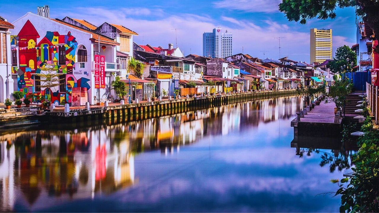
The photo shows Malacca’s riverfront at dusk, the calm 20-metre-wide canal reflecting century-old shophouses painted in muted pastels. A promenade—roughly 5 metres deep and lined with granite-edged bollards—runs along the right bank, while on the left a boldly colored mural animates a restored shop-house façade. In the background, a modern high-rise hotel (25 storeys) and a yellow office tower punctuate the skyline. Potted vines drape over low parapets, and overhead fairy-lights linger in the soft twilight. The scene blends heritage architecture, urban greenery, and a 1.6-kilometre riverwalk that threads through Malacca’s Unesco-inscribed core. On Day 11 the Egyptian delegates examined this very stretch during the 1999–2001 Malacca River Rehabilitation, noting how RM 140 million in dredging and granite revetments had created the 1.6 km promenade. They measured water-depth increases—from an average of 1 m pre-rehab to 3 m post-rehab—and timed footfall peaks of 1,200 pedestrians per hour on market evenings. These findings showed how ecological engineering and low-cost placemaking can catalyze tourism, flood control, and private investment—lessons OHK translated into design guidelines for Egypt’s New Administrative Capital.
Day 12 – Rain‑Forest Retreat to Forge the Roadmap: From Quiet Hillside Reflection to a Six‑Point, Action‑Driven Blueprint for Egypt’s New Capital
On a day meant to be a breather from the delegation’s whirlwind of construction sites and boardrooms, the group traded conference badges for hiking boots and drove into the fog‑softened hills of Hulu Langat. Their base—a bamboo eco‑lodge with an open thatch pavilion—offered flickering electricity, nearly nonexistent phone reception, and the quiet needed for focused thought. Over steaming kopi tarik, OHK invited each participant to voice one insight that would still matter ten years later. The supposedly restful exercise erupted into a torrent of ideas: the time savings of a one‑stop development authority, the three‑degree‑Celsius cooling edge of blue‑green corridors over mechanical chillers, the way visible skyline steel unlocks air‑rights sales to finance rail, and the revenue power of heritage levies that both safeguard and grow urban value.
By midday the facilitators had clustered these insights under six headings—governance architecture, finance and land value, mobility spine, blue‑green infrastructure, digital backbone, and people and story—which the group adopted as the scaffold for a working paper already nicknamed “Toward an Egyptian Administrative Hub.” Breakout huts scattered around the lodge became pop‑up studios where teams drafted one‑sentence mandates, matched each to a metric, and set first‑step deadlines. One text called for a single NAC Development Authority empowered to issue and enforce all planning and utility concessions within thirty days of application; another set a forty‑five‑minute platform‑to‑platform goal for an electrified express‑rail link between Ramses Station and the future capital, beginning with a topographic survey of the desert corridor within ninety days. Before wrapping up, every delegate penned three notebook lines: the principal risk—diffused authority—the quickest win—announcing the single‑agency charter before the first brick is laid—and a personal pledge to champion one of the six action strands. Day 12 closed not with site inspections or new data but with a shared, action‑driven roadmap ready to travel from the Malaysian rain forest to Egypt’s eastern desert. That night the delegates slept in the eco‑lodge, the quiet hillsides echoing only with cicadas and the distant rush of monsoon streams.
Day 13 – Stress‑Testing the Blueprint: Diplomatic Panel Review, Iteration Loops, and a Sunset Cruise that Sealed Cross‑Border Commitments
Back in Putrajaya after the rain‑forest retreat, the delegation assembled at 09:00 in Wisma Putra’s newly occupied auditorium in Precinct 2. The Ministry of Foreign Affairs—barely four months into its headquarters—had convened a joint panel that brought together two Egyptian embassy counsellors, senior officers from Putrajaya Corporation, and economists from Malaysia’s Economic Planning Unit. OHK opened with a brisk recap of the six action points drafted in Hulu Langat, projecting one slide per point and tying every proposal to a firm 2002 benchmark. For three hours the panel tested each assumption. Putrajaya’s chief engineer asked whether a 40 percent open‑space ratio could survive Egypt’s harsher climate, while the Foreign Affairs under‑secretary pressed on political feasibility, noting that Malaysia’s own relocation had required Cabinet approval of a single authority—“Would the Egyptian Parliament grant similar latitude?” Yellow legal pads filled quickly, and several metrics were revised: the express‑rail goal widened to “under one hour” platform‑to‑platform to allow future intermediate stops, and the blue‑green land target eased to “not less than one‑third of gross area,” still bold but better suited to desert hydrology.
After lunch the delegates split into “iteration loops.” Each loop paired an Egyptian official with a Malaysian counterpart who had experienced Putrajaya’s early hurdles—utility concessions, land auctions, staff relocation. Seated at circular tables, they marked up the draft memo in red and blue ink, tightening language and flagging clauses that would need Egyptian legal adjustments. By 17:30 the footer read Draft 1.1. Evening brought a change of setting: the group boarded an aluminium‑hulled inspection vessel—half workboat, half floating boardroom—chartered from the Putrajaya Lake authority. Over supper on deck they compared next steps. Malaysia offered a short‑term secondment of two planners to Cairo; Egypt counter‑proposed reciprocal internships for young civil servants once the NAC site office opened. As the vessel glided beneath the unfinished arches of Seri Wawasan Bridge, a Malaysian delegate raised a toast: “From blueprint to earth, and from Putrajaya to Cairo.” When the boat docked, the draft memorandum bore fresh signatures from both sides and a pencilled timetable: transmit to Egypt’s Cabinet within a week, circulate to key ministries by mid‑February, and place it on the agenda of the first joint Egypt–Malaysia planning forum in April 2002. Day 13 closed with the roadmap sharpened by scrutiny and buoyed by cross‑border commitment.
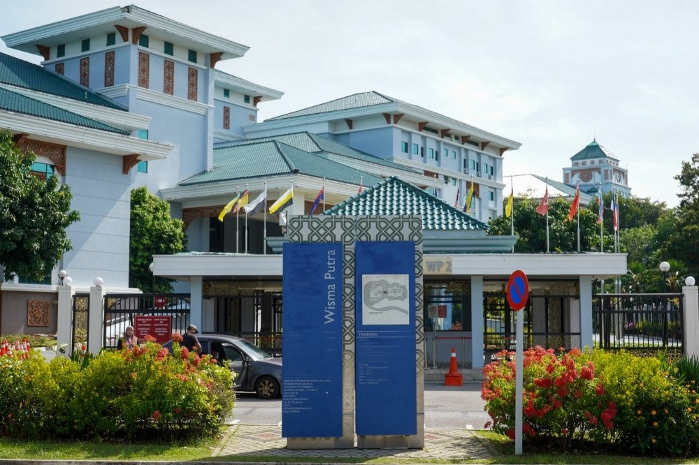
The photo shows the Wisma Putra complex in Precinct 2, Putrajaya, which houses Malaysia’s Ministry of Foreign Affairs. It served as the venue for the Day 13 diplomatic panel, where the Egyptian delegation presented and stress-tested their six-point roadmap in the building’s newly opened auditorium.
Day 14 – Homebound Horizons: Dawn Farewell, In‑Flight Synthesis, and the Notebook That Carried a Capital
On the last day, the delegation gathered at the water’s edge. A tripod stood on the promenade beneath the near‑finished Seri Wawasan Bridge, its steel ribs still half‑shrouded in scaffolding. The group posed for a final photograph—Malaysia’s young administrative city framing the people now intent on building Egypt’s. Cameras clicked and a few delegates pocketed small pebbles from the shoreline as mementos. By 08:30 two coaster buses were easing north toward Kuala Lumpur International Airport. The mood was quieter than on earlier drives and most chose to watch the palm estates unspool beyond the windows. At the terminal OHK handed each participant a slim envelope containing the Draft 1.1 memo, a CD‑ROM of Putrajaya case files, and a blank page headed “First Three Tasks on Landing. Malaysia Airlines Flight MH 154 lifted off just after noon. After lunch, the OHK team passed to the delegates a sketch of a crescent east of Cairo, labelled it Cairo East Administrative Axis, and drew three thick lines: one for a future express rail, one for a ceremonial boulevard, and one for a linear park stitched with storm‑water basins. In the margins, a simple equation: “One agency + one rail spine + one green river = livable capital.”
Touchdown at Cairo International came just after sunset. As passports were stamped and luggage reclaimed, the last day ended where the first had begun: in Cairo. Yet the notebooks, poster tubes, and signed pledges now bridged two continents, carrying with them a disciplined, metrics‑driven vision. Within a week the “Toward an Egyptian Administrative Hub” memo would cross the Prime Minister’s desk.
As the sun sets on Putrajaya’s mirrored boulevards and fountains, it reminds us that the truest capital is not measured in concrete and glass but in the ideas we carry home. What began as a journey of observation became a forge for transformation—where quiet lakes taught the power of blue-green design, empty boulevards whispered of civic possibility, and a simple notebook sketched the outlines of a nation’s future. In those days of disciplined inquiry and open-minded curiosity, OHK intended the seeds of Egypt’s New Administrative Capital to be sown—not as grand monuments to a single era, but as living laboratories in which policy, place, and people converge. The real legacy of such efforts lives on in every decision-maker who dares to look beyond borders, to translate distant lessons into homegrown ambition, and to build not just a city, but a collective vision for tomorrow.
Over the past three decades, OHK has designed and led dozens of bespoke study tours—ranging from Putrajaya’s purpose-built capital to emerging innovation districts—to address diverse development challenges, from urban governance to smart-city infrastructure. These immersive experiences translate global best practices into actionable strategies, empowering decision-makers to leapfrog conventional approaches. To discover how our study tours can catalyze your next landmark project and advance your economic and urban agendas, contact us to explore our tailored learning expeditions.